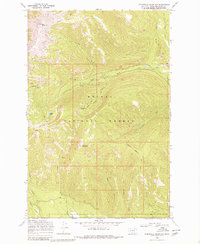
1968 Map of Stonewall Mountain
USGS Topo · Published 1980About this map
Stonewall Mountain and Red Mountain anchor this high-elevation terrain within the Helena National Forest, where the landscape is defined by the headwaters of the North Fork Blackfoot River. The 1968 field survey documents a remote mountain economy centered on mineral extraction and livestock movement. Evidence of prospecting is clear at Copper Camp and the Cotter Mine, while a network of pack trails and jeep trails provides the primary access through the steep drainages of Snowbank Creek and Stonewall Creek. The presence of several unnamed mines alongside Copper Lake suggests a period of active exploration or small-scale operations in this portion of Lewis and Clark County before more modern wilderness management practices predominated.
Find a feature on this map
20 named features on this map. Tap any name to fly to it.
Don’t see what you’re looking for? This feature index may not catch every label — zoom into the map to look around manually.
Map Details
Editions of this 1968 Stonewall Mountain Map
3 editions found
Other maps of this area

1889 · Helena
USGS Topo · 1:250,000

1893 · Helena
USGS Topo · 1:250,000

1899 · Helena
USGS Topo · 1:250,000

1903 · Coopers Lake
USGS Topo · 1:125,000

1903 · Helena
USGS Topo · 1:250,000

1947 · Butte
USGS Topo · 1:250,000

1955 · Choteau
USGS Topo · 1:250,000

1957 · Choteau
USGS Topo · 1:250,000

1958 · Butte
USGS Topo · 1:250,000

1958 · Choteau
USGS Topo · 1:250,000