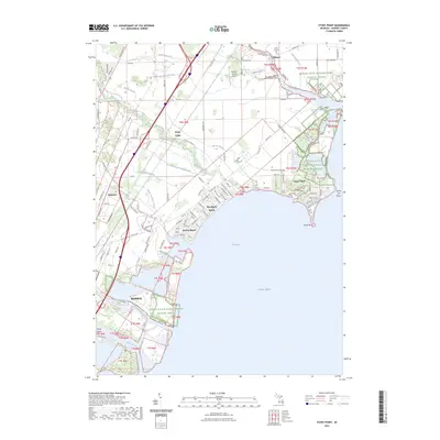
2023 Map of Stony Point
USGS Topo · Published 2023About this map
Brest Bay and the western shores of Lake Erie dominate this coastal survey of Monroe County. The landscape is characterized by its complex network of drainage ditches and creeks, such as the Webb and Reisdorf Drain and Little Swan Creek, which support a series of residential beach communities. Settlements like Woodland Beach and Detroit Beach are densely platted along the shoreline, while the southern edge transition into the city of Monroe near the mouth of the River Raisin. Significant conservation areas, including the Detroit River International Wildlife Refuge and Sterling State Park, preserve the marshy lakefront between developed areas. Local history is anchored by sites such as Saint Charles Cem and Old Saint Charles Cem near Oldport, alongside the small Newport Woods Airport inland.
Find a feature on this map
111 named features on this map. Tap any name to fly to it.
Don’t see what you’re looking for? This feature index may not catch every label — zoom into the map to look around manually.
Map Details
Editions of this 2023 Stony Point Map
This is the sole edition of this map. No revisions or reprints were ever made.
Other maps of this area

1906 · Wyandotte
USGS Topo · 1:62,500

1906 · Romulus
USGS Topo · 1:62,500

1912 · Wyandotte
USGS Topo · 1:62,500

1912 · Monroe
USGS Topo · 1:62,500

1914 · Monroe
USGS Topo · 1:62,500

1927 · Monroe
USGS Topo · 1:31,680

1928 · Romulus
USGS Topo · 1:62,500

1929 · Wyandotte
USGS Topo · 1:62,500

1936 · Rockwood
USGS Topo · 1:31,680

1936 · Stony Point
USGS Topo · 1:31,680
Featured Places
- Frenchtown Charter Township, MI
- Monroe, MI
- Monroe Charter Township, MI
- Berlin Charter Township, MI
- Detroit Beach, Frenchtown Charter Township