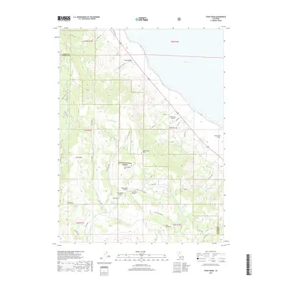
2018 Map of Stony Ridge
USGS Topo · Published 2018About this map
Plumas National Forest dominates the high ground in this 2018 survey, where the Sierra Nevada transitions toward the Great Basin. The landscape is defined by the steep descent from Stony Ridge and Cottonwood Mtn down into the Honey Lake Valley. This eastern slope of the mountains is marked by a complex network of forest roads and spurs, such as Clarks Parallel and Chimp Spur, which provide access to remote springs and peaks. The settlement of Big Flat and the Fitch Middle School sit at the base of the mountains, illustrating the localized concentration of infrastructure where the canyons open onto the flats. Water management is evident through features like the Doyle Reservoir and numerous named water sources including Big Flat Spring and Bell Spring, which support the arid environment of the High Desert fringe near Honey Lake.
Find a feature on this map
58 named features on this map. Tap any name to fly to it.
Don’t see what you’re looking for? This feature index may not catch every label — zoom into the map to look around manually.
Map Details
Editions of this 2018 Stony Ridge Map
This is the sole edition of this map. No revisions or reprints were ever made.
Other maps of this area

1886 · Honey Lake
USGS Topo · 1:250,000

1891 · Honey Lake
USGS Topo · 1:250,000

1893 · Honey Lake
USGS Topo · 1:250,000

1950 · Kettle Rock
USGS Topo · 1:62,500

1950 · Milford
USGS Topo · 1:62,500

1954 · Susanville
USGS Topo · 1:62,500

1954 · Litchfield
USGS Topo · 1:62,500

1955 · Westwood
USGS Topo · 1:250,000

1958 · Westwood
USGS Topo · 1:250,000

1959 · Westwood
USGS Topo · 1:250,000