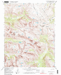
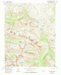
1964 Map of Storm King Peak
USGS Topo · Published 1984About this map
San Juan National Forest and Rio Grande National Forest converge at the Continental Divide, marking a landscape defined by high-altitude peaks and glacial lakes. This 1964 field-checked survey reveals the high Grenadier Range and Needle Mountains, where sharp summits like Vestal Peak and Jagged Mountain dominate the skyline. In the northeast corner, the Beartown (site) reflects the era's fading mining footprint, surrounded by several unnamed mines and prospects near Kite Lake.
Find a feature on this map
79 named features on this map. Tap any name to fly to it.
Don’t see what you’re looking for? This feature index may not catch every label — zoom into the map to look around manually.
Map Details
Editions of this 1964 Storm King Peak Map
5 editions found
Other maps of this area

1897 · Silverton
USGS Topo · 1:62,500

1900 · Needle Mountains
USGS Topo · 1:62,500

1901 · Silverton
USGS Topo · 1:62,500

1902 · Needle Mountains
USGS Topo · 1:62,500

1902 · Silverton
USGS Topo · 1:62,500

1905 · San Cristobal
USGS Topo · 1:125,000

1907 · San Cristobal
USGS Topo · 1:125,000

1945 · Durango
USGS Topo · 1:250,000

1953 · Durango
USGS Topo · 1:250,000

1954 · Durango
USGS Topo · 1:250,000