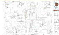
1985 Map of Storm Lake
USGS Topo · Published 1985About this map
The Little Sioux River and its numerous tributaries, including Mill Creek and Willow Creek, carve a detailed drainage network across this Northwest Iowa landscape. By the mid-1980s, the region's agricultural character is well-established, anchored by the hub of Cherokee and the lakeside communities of Storm Lake and Lakeside. Transportation is dominated by the intersecting lines of the Illinois Central Gulf Railroad and the Chicago and North Western Railroad, which link smaller grain-handling settlements like Aurelia, Marcus, and Paullina.
Find a feature on this map
99 named features on this map. Tap any name to fly to it.
Don’t see what you’re looking for? This feature index may not catch every label — zoom into the map to look around manually.
Map Details
Editions of this 1985 Storm Lake Map
3 editions found
Other maps of this area

1954 · Fairmont
USGS Topo · 1:250,000

1954 · Fort Dodge
USGS Topo · 1:250,000

1955 · Sioux City
USGS Topo · 1:250,000

1955 · Sioux Falls
USGS Topo · 1:250,000

1957 · Fort Dodge
USGS Topo · 1:250,000

1958 · Sioux City
USGS Topo · 1:250,000

1958 · Sioux Falls
USGS Topo · 1:250,000

1958 · Fort Dodge
USGS Topo · 1:250,000

1958 · Fairmont
USGS Topo · 1:250,000

1959 · Sioux City
USGS Topo · 1:250,000