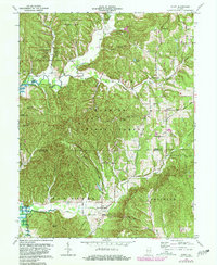
1967 Map of Story
USGS Topo · Published 1981About this map
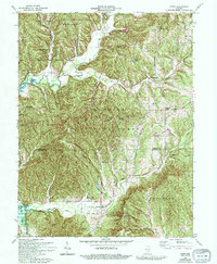
Story and Elkinsville serve as primary anchors for this southern Indiana landscape, which is defined by the convergence of public lands and rugged township boundaries. The map illustrates a complex topography of ridges and hollows, including Bald Knobs and Hominy Mortar Ridge, that dictated the winding paths of the early road network. Evidence of local community life is preserved through numerous family and rural burial sites such as Moffitt Cem, Lutes Cem, and McKinney Cem, alongside the Mt Zion Ch near the northern border. This 1967 revision captures the area as the Monroe Lake reservoir began to influence the western terrain, contrasting the managed wilderness of the Hoosier National Forest and Yellowwood State Forest with the established crossroads at Christiansburg and Houston. The inclusion of the Old Indian Treaty Road provides a specific connection to the region's historical surveying and land division legacy.
Find a feature on this map
68 named features on this map. Tap any name to fly to it.
Don’t see what you’re looking for? This feature index may not catch every label — zoom into the map to look around manually.
Map Details
Editions of this 1967 Story Map
7 editions found
Other maps of this area

1934 · Bedford
USGS Topo · 1:48,000

1937 · Bedford
USGS Topo · 1:62,500

1942 · Franklin
USGS Topo · 1:125,000

1946 · Belmont
USGS Topo · 1:24,000

1947 · Nashville
USGS Topo · 1:24,000

1947 · Elkinsville
USGS Topo · 1:24,000

1948 · New Bellsville
USGS Topo · 1:24,000

1948 · Waymansville
USGS Topo · 1:24,000

1949 · Nashville
USGS Topo · 1:24,000

1950 · Belmont
USGS Topo · 1:24,000