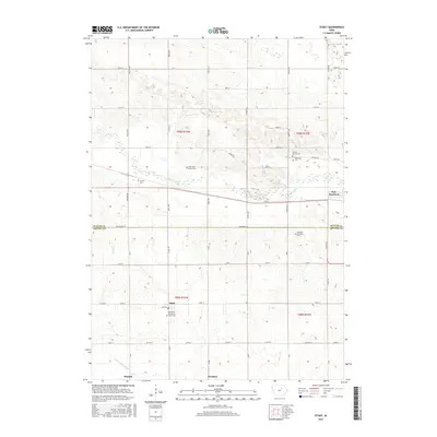
2015 Map of Stout
USGS Topo · Published 2015About this map
Stout stands as a primary focal point in this 2015 survey of the borderlands between Butler and Grundy counties. The settlement pattern is characterized by a high concentration of burial sites and rural markers, including the Reformed Church of Stout Cem and several family or community plots such as Beaver Grove Cem, Behrends Cem, and Codner Cem. These features, alongside the Fairfield Township Cem, suggest a deeply rooted agricultural community with generations of local history etched into the landscape.
Find a feature on this map
47 named features on this map. Tap any name to fly to it.
Don’t see what you’re looking for? This feature index may not catch every label — zoom into the map to look around manually.
Map Details
Editions of this 2015 Stout Map
This is the sole edition of this map. No revisions or reprints were ever made.
Other maps of this area

1954 · Waterloo
USGS Topo · 1:250,000

1955 · Waterloo
USGS Topo · 1:250,000

1971 · Zaneta
USGS Topo · 1:24,000

1971 · Shell Rock
USGS Topo · 1:24,000

1971 · Dike
USGS Topo · 1:24,000

1971 · Coster
USGS Topo · 1:24,000

1971 · Stout
USGS Topo · 1:24,000
1971 · New Hartford
USGS Topo · 1:24,000

1979 · Holland
USGS Topo · 1:24,000

1979 · Butler Center
USGS Topo · 1:24,000