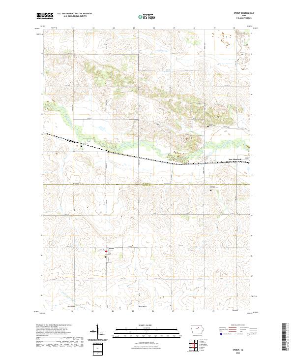
2022 Map of Stout
USGS Topo · Published 2022About this map
Beaver Creek meanders through the heart of this Grundy and Butler County landscape, marking a terrain defined by agricultural grid lines and the small rural centers of Stout and New Hartford. The map illustrates the late-twentieth-century rural layout, where primary roads like Westbrook St and Co Rd T55 connect isolated farmsteads and historic burial grounds. The transition from the Butler Co line into Grundy Co is punctuated by significant genealogical landmarks, including Beaver Grove Cem and Codner Cem. In the southern reaches, the N Fork Black Hawk Cr passes near the settlement of Sinclair, showing the persistent influence of local waterways on the region's development. This survey serves as a clear record of the enduring township structures and road networks that have supported this Iowa farming community for generations.
Find a feature on this map
45 named features on this map. Tap any name to fly to it.
Don’t see what you’re looking for? This feature index may not catch every label — zoom into the map to look around manually.
Map Details
Editions of this 2022 Stout Map
This is the sole edition of this map. No revisions or reprints were ever made.
Other maps of this area

1954 · Waterloo
USGS Topo · 1:250,000

1955 · Waterloo
USGS Topo · 1:250,000

1971 · Zaneta
USGS Topo · 1:24,000

1971 · Shell Rock
USGS Topo · 1:24,000

1971 · Dike
USGS Topo · 1:24,000

1971 · Coster
USGS Topo · 1:24,000

1971 · Stout
USGS Topo · 1:24,000
1971 · New Hartford
USGS Topo · 1:24,000

1979 · Holland
USGS Topo · 1:24,000

1979 · Butler Center
USGS Topo · 1:24,000