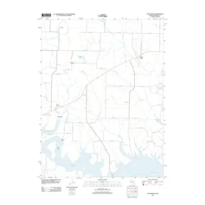
2012 Map of Stoutsville
USGS Topo · Published 2012About this map
Stoutsville and the surrounding Monroe County landscape are defined by the extensive reaches of Mark Twain Lake, which dominates the southern half of this modern topographical study. The topography reveals a transition from traditional agricultural land to a complex riparian environment shaped by the creation of the reservoir. To the north, small settlements like Clapper and Indian Creek persist among a network of rural routes such as Co RD-511 and Co RD-486. Local history is anchored by sites like Saint Andrews Cemetery and Jeter Cemetery, while the hydrological landscape is fed by numerous tributaries including Buck Creek, Deer Creek, and Shell Branch. Significant river crossings, such as the Fishtrap Bridge and the uniquely named Kitty Wheelin Ford, provide specific points of interest for those tracing the historical movement and development patterns of this part of Missouri.
Find a feature on this map
60 named features on this map. Tap any name to fly to it.
Don’t see what you’re looking for? This feature index may not catch every label — zoom into the map to look around manually.
Map Details
Editions of this 2012 Stoutsville Map
This is the sole edition of this map. No revisions or reprints were ever made.
Other maps of this area

1890 · Mexico
USGS Topo · 1:125,000

1903 · Palmyra
USGS Topo · 1:125,000

1945 · Florida
USGS Topo · 1:62,500

1945 · Perry
USGS Topo · 1:62,500

1948 · Quincy
USGS Topo · 1:250,000

1956 · Quincy
USGS Topo · 1:250,000

1959 · Monroe City
USGS Topo · 1:24,000

1959 · Lakenan
USGS Topo · 1:24,000

1959 · Joanna
USGS Topo · 1:24,000

1959 · Hunnewell
USGS Topo · 1:24,000