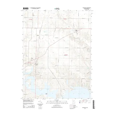
2015 Map of Stoutsville
USGS Topo · Published 2015About this map
Stoutsville and the surrounding Monroe County landscape are defined by the irregular shoreline of Mark Twain Lake, which dominates the southern and eastern portions of this map. This modern topography reveals a rural geography where older settlements like Clapper and Indian Creek persist alongside the expansive reservoir. The terrain is marked by numerous drainage ways, including Buck Creek, Deer Creek, and Shell Branch, which carve through the rolling uplands. For those researching local history, several burial sites are preserved here, such as Jeter Cemetery and Saint Andrews Cemetery. The map also identifies Leich Ford at the lake's edge, a name that recalls earlier river crossings before the valley was flooded. A network of county roads, such as Monroe Road 370 and Monroe Road 460, provides the primary infrastructure for this agricultural and recreational region.
Find a feature on this map
58 named features on this map. Tap any name to fly to it.
Don’t see what you’re looking for? This feature index may not catch every label — zoom into the map to look around manually.
Map Details
Editions of this 2015 Stoutsville Map
This is the sole edition of this map. No revisions or reprints were ever made.
Other maps of this area

1890 · Mexico
USGS Topo · 1:125,000

1903 · Palmyra
USGS Topo · 1:125,000

1945 · Florida
USGS Topo · 1:62,500

1945 · Perry
USGS Topo · 1:62,500

1948 · Quincy
USGS Topo · 1:250,000

1956 · Quincy
USGS Topo · 1:250,000

1959 · Monroe City
USGS Topo · 1:24,000

1959 · Lakenan
USGS Topo · 1:24,000

1959 · Joanna
USGS Topo · 1:24,000

1959 · Hunnewell
USGS Topo · 1:24,000