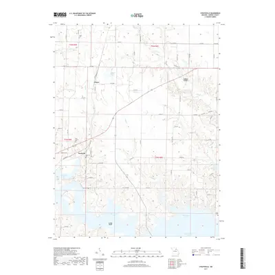
2017 Map of Stoutsville
USGS Topo · Published 2017About this map
Mark Twain Lake dominates the southern half of this landscape, its intricate shoreline carving deep into the Monroe County countryside. The village of Stoutsville sits just north of the lake's reach, positioned near the junction of Monroe Rd 486 and Monroe Rd 480. This modern survey reveals a region where traditional land divisions meet the large-scale water management of the Salt River system, impacting local geography and road networks.
Find a feature on this map
64 named features on this map. Tap any name to fly to it.
Don’t see what you’re looking for? This feature index may not catch every label — zoom into the map to look around manually.
Map Details
Editions of this 2017 Stoutsville Map
This is the sole edition of this map. No revisions or reprints were ever made.
Other maps of this area

1890 · Mexico
USGS Topo · 1:125,000

1903 · Palmyra
USGS Topo · 1:125,000

1945 · Florida
USGS Topo · 1:62,500

1945 · Perry
USGS Topo · 1:62,500

1948 · Quincy
USGS Topo · 1:250,000

1956 · Quincy
USGS Topo · 1:250,000

1959 · Monroe City
USGS Topo · 1:24,000

1959 · Lakenan
USGS Topo · 1:24,000

1959 · Joanna
USGS Topo · 1:24,000

1959 · Hunnewell
USGS Topo · 1:24,000