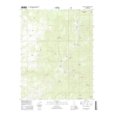
2017 Map of Straight Canyon
USGS Topo · Published 2017About this map
Dixie National Forest defines the northern reaches of this Kane County landscape, where high plateaus and deep drainage systems converge. The map illustrates a complex network of geological features, including the flat expanse of The Plains and the prominent Millet Point. Water sources like Upper Bear Spring and Lower Bear Spring are critical markers in this arid environment, feeding into a system of named canyons such as Ashdown Canyon and Rosy Canyon. The southern portion is dominated by the winding path of the N Fork Virgin River and the branching topography of Orderville Gulch. Tracing the local roads like Co RD 89w14 and Hay Canyon Rd reveals how modern transit follows the natural contours of the land, connecting landmarks like Horse Knoll and Table Bench across the high-elevation terrain.
Find a feature on this map
46 named features on this map. Tap any name to fly to it.
Don’t see what you’re looking for? This feature index may not catch every label — zoom into the map to look around manually.
Map Details
Editions of this 2017 Straight Canyon Map
This is the sole edition of this map. No revisions or reprints were ever made.
Other maps of this area

1886 · Kanab
USGS Topo · 1:250,000

1953 · Cedar City
USGS Topo · 1:250,000

1954 · Orderville Canyon NW
USGS Topo · 1:24,000

1954 · Orderville Canyon SE
USGS Topo · 1:24,000

1957 · Orderville Canyon NE
USGS Topo · 1:24,000

1958 · Cedar City
USGS Topo · 1:250,000

1958 · Orderville
USGS Topo · 1:62,500

1958 · Cedar Breaks
USGS Topo · 1:62,500

1958 · Panguitch Lake
USGS Topo · 1:62,500

1962 · Cedar City
USGS Topo · 1:250,000