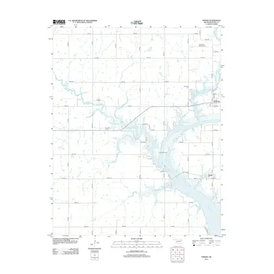
2012 Map of Strang
USGS Topo · Published 2012About this map
The Neosho River carves a winding path through this portion of Mayes County, defining the landscape around the settlements of Strang and Pensacola. The river's broad channel and associated backwaters create a complex riparian network fed by tributaries such as Big Cabin Cr and Rock Cr. This 2012 survey illustrates a predominantly rural environment where the section-line road grid remains the primary infrastructure, connecting dispersed homesteads and family landmarks.
Find a feature on this map
48 named features on this map. Tap any name to fly to it.
Don’t see what you’re looking for? This feature index may not catch every label — zoom into the map to look around manually.
Map Details
Editions of this 2012 Strang Map
This is the sole edition of this map. No revisions or reprints were ever made.
Other maps of this area

1896 · Pryor
USGS Topo · 1:125,000

1901 · Vinita
USGS Topo · 1:125,000

1901 · Pryor
USGS Topo · 1:125,000

1913 · Vinita
USGS Topo · 1:125,000

1954 · Tulsa
USGS Topo · 1:250,000

1958 · Tulsa
USGS Topo · 1:250,000

1963 · Tulsa
USGS Topo · 1:250,000

1969 · Adair
USGS Topo · 1:24,000

1970 · White Oak
USGS Topo · 1:24,000
1970 · Pryor
USGS Topo · 1:24,000