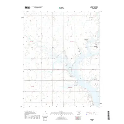
2019 Map of Strang
USGS Topo · Published 2019About this map
The Neosho River dominates the center of this Mayes County survey, carving a wide path southward toward Galloway Bay. Along its eastern banks, the small community of Strang is laid out on a grid including Broadway and Hill Road, serving as a focal point for the surrounding rural landscape. To the north, Pensacola sits near the confluence of Big Cabin Creek and the river, marking another established settlement within this pocket of northeast Oklahoma.
Find a feature on this map
46 named features on this map. Tap any name to fly to it.
Don’t see what you’re looking for? This feature index may not catch every label — zoom into the map to look around manually.
Map Details
Editions of this 2019 Strang Map
This is the sole edition of this map. No revisions or reprints were ever made.
Other maps of this area

1896 · Pryor
USGS Topo · 1:125,000

1901 · Vinita
USGS Topo · 1:125,000

1901 · Pryor
USGS Topo · 1:125,000

1913 · Vinita
USGS Topo · 1:125,000

1954 · Tulsa
USGS Topo · 1:250,000

1958 · Tulsa
USGS Topo · 1:250,000

1963 · Tulsa
USGS Topo · 1:250,000

1969 · Adair
USGS Topo · 1:24,000

1970 · White Oak
USGS Topo · 1:24,000
1970 · Pryor
USGS Topo · 1:24,000