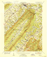
1950 Map of Strasburg
USGS Topo · Published 1950About this map
The North Fork Shenandoah River and South Fork Shenandoah River define this mid-century landscape, carving deep loops around the massive bulk of Massanutten Mountain. Near Strasburg, the Southern railroad and Lee Highway establish a primary transit corridor, while the Norfolk and Western line services the river valley to the east. The internal valley known as Fort Valley appears as a sheltered agricultural enclave, home to Seven Fountains and Detrick, accessible only through narrow gaps like Mudhole Gap or Woodstock Gap. Local life is anchored by numerous rural institutions, including Saint Davids Church, Bennett Chapel, and the Otterburn Sch. Industry and recreation are represented by the Fish Hatchery near Waterlick and the Elizabeth Furnace Recreational Area, reflecting the dual role of the George Washington National Forest as both a resource and a destination.
Find a feature on this map
123 named features on this map. Tap any name to fly to it.
Don’t see what you’re looking for? This feature index may not catch every label — zoom into the map to look around manually.
Map Details
Editions of this 1950 Strasburg Map
2 editions found

Other maps of this area

1891 · Romney
USGS Topo · 1:125,000

1892 · Woodstock
USGS Topo · 1:125,000

1893 · Luray
USGS Topo · 1:125,000

1894 · Winchester
USGS Topo · 1:125,000

1905 · Luray
USGS Topo · 1:125,000

1922 · Wardensville
USGS Topo · 1:62,500

1923 · Middletown
USGS Topo · 1:62,500

1923 · Edinburg
USGS Topo · 1:62,500

1924 · Wardensville
USGS Topo · 1:62,500

1929 · Stony Man
USGS Topo · 1:48,000