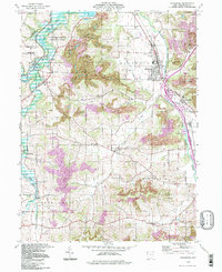
1994 Map of Strasburg
USGS Topo · Published 1998About this map
Sugar Creek winds through this corner of Tuscarawas County, defining a landscape shaped by coal extraction and industrial clay production. The villages of Strasburg and Dundee serve as primary hubs, connected by the W & L E railroad corridor. The prevalence of Strip Mine operations and numerous Kilns near Columbia and Beartown illustrates the region's heavy reliance on mineral resources during the late twentieth century.
Find a feature on this map
48 named features on this map. Tap any name to fly to it.
Don’t see what you’re looking for? This feature index may not catch every label — zoom into the map to look around manually.
Map Details
Editions of this 1994 Strasburg Map
This is the sole edition of this map. No revisions or reprints were ever made.
Other maps of this area

1909 · Uhrichsville
USGS Topo · 1:62,500

1911 · Uhrichsville
USGS Topo · 1:62,500

1911 · Newcomerstown
USGS Topo · 1:62,500

1912 · Dover
USGS Topo · 1:62,500

1913 · Newcomerstown
USGS Topo · 1:62,500

1914 · Navarre
USGS Topo · 1:62,500

1943 · Newcomerstown
USGS Topo · 1:62,500

1944 · Navarre
USGS Topo · 1:62,500

1944 · Dover
USGS Topo · 1:62,500

1951 · Canton
USGS Topo · 1:250,000