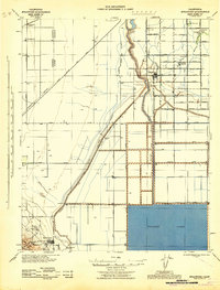
1943 Map of Stratford
USGS Topo · Published 1943About this map
The Kings River dominates this San Joaquin Valley landscape, its course managed by Empire Weir No 1 and Empire Weir No 2 as it flows toward the expansive Tulare Lake in the south. The 1943 survey captures an agricultural region defined by a rigid grid of avenues and massive water control projects, including the Empire Canal, Outside Waterway, and Blakeley Canal. These systems enabled the development of settlements like Stratford and the Rancheria Santa Rosa, which stand in contrast to the industrial infrastructure found to the southwest.
Find a feature on this map
47 named features on this map. Tap any name to fly to it.
Don’t see what you’re looking for? This feature index may not catch every label — zoom into the map to look around manually.
Map Details
Editions of this 1943 Stratford Map
This is the sole edition of this map. No revisions or reprints were ever made.
Other maps of this area

1912 · Coalinga
USGS Topo · 1:125,000

1914 · Lost Hills
USGS Topo · 1:125,000

1914 · Cholame
USGS Topo · 1:125,000

1915 · Cholame
USGS Topo · 1:125,000

1917 · Cholame
USGS Topo · 1:125,000

1926 · Hanford
USGS Topo · 1:31,680

1926 · Lethent
USGS Topo · 1:31,680

1927 · Lemoore
USGS Topo · 1:31,680

1929 · Guernsey
USGS Topo · 1:31,680

1929 · Stratford
USGS Topo · 1:31,680