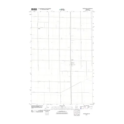
2010 Map of Strathcona
USGS Topo · Published 2010About this map
Strathcona serves as the central hub for this rural Roseau County landscape, defined by a rigorous grid of section-line roads and agricultural tracts. The small settlement is anchored by the Strathcona Post Office, which remains a vital point of connection for the surrounding farming community. The geographic layout reflects the systematic land surveys of northern Minnesota, where arterial routes like County Hwy-29 and County Hwy-8 facilitate the movement of goods and people across the flat terrain. Local history is etched into the land at Bethlehem Cemetery in the northwest and Greenwood Cemetery just north of the town site. These locations, along with the transition marked by County Line Rd Ne, provide essential spatial references for genealogists and researchers mapping out family plots and early 21st-century property boundaries in this remote corner of the state.
Find a feature on this map
20 named features on this map. Tap any name to fly to it.
Don’t see what you’re looking for? This feature index may not catch every label — zoom into the map to look around manually.
Map Details
Editions of this 2010 Strathcona Map
This is the sole edition of this map. No revisions or reprints were ever made.
Other maps of this area

1918 · Greenbush
USGS Topo · 1:62,500

1918 · Middle River
USGS Topo · 1:62,500

1919 · Pelan
USGS Topo · 1:62,500

1952 · Thief River Falls
USGS Topo · 1:250,000

1956 · Thief River Falls
USGS Topo · 1:250,000

1957 · Thief River Falls
USGS Topo · 1:250,000

1957 · Newfolden
USGS Topo · 1:62,500

1957 · Pelan
USGS Topo · 1:62,500
1961 · Middle River NE
USGS Topo · 1:24,000

1962 · Strathcona
USGS Topo · 1:24,000