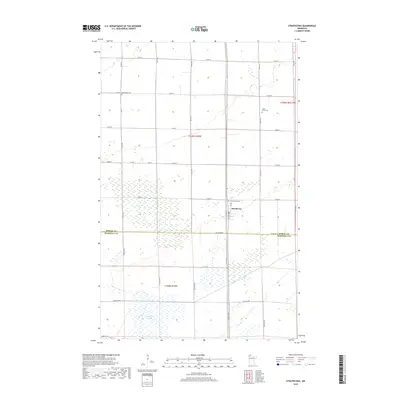
2019 Map of Strathcona
USGS Topo · Published 2019About this map
Strathcona sits at the heart of this North Country landscape, positioned near the boundary between Roseau and Marshall counties. This 2019 survey illustrates a region defined by extensive wetland networks and agricultural drainage, most notably the Judicial Ditch Number Nineteen that segments the southern portion of the quadrangle. The map is a vital resource for genealogical research, identifying three distinct burial grounds that serve the local rural community: Bethlehem Cem to the northwest, Poplar Grove Cem to the northeast, and Greenwood Cem situated just west of the town center. The rigid grid of township roads, such as Co Rd 8 and Co Hwy 27, highlights the systematic land division of the American Midwest while navigating the complex hydrology of the surrounding marshlands.
Find a feature on this map
32 named features on this map. Tap any name to fly to it.
Don’t see what you’re looking for? This feature index may not catch every label — zoom into the map to look around manually.
Map Details
Editions of this 2019 Strathcona Map
This is the sole edition of this map. No revisions or reprints were ever made.
Other maps of this area

1918 · Greenbush
USGS Topo · 1:62,500

1918 · Middle River
USGS Topo · 1:62,500

1919 · Pelan
USGS Topo · 1:62,500

1952 · Thief River Falls
USGS Topo · 1:250,000

1956 · Thief River Falls
USGS Topo · 1:250,000

1957 · Thief River Falls
USGS Topo · 1:250,000

1957 · Newfolden
USGS Topo · 1:62,500

1957 · Pelan
USGS Topo · 1:62,500
1961 · Middle River NE
USGS Topo · 1:24,000

1962 · Strathcona
USGS Topo · 1:24,000