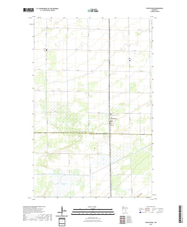
2022 Map of Strathcona
USGS Topo · Published 2022About this map
Strathcona sits at the heart of this agricultural landscape in the Red River Valley region, where the flat terrain of Northwest Minnesota meets a network of managed water systems. The map illustrates a highly organized grid of rural roads and section lines, interrupted only by the marshy expanse of Thompsons Slough and the engineered path of Judicial Ditch Number Nineteen. These drainage features are critical to the region's farming heritage, turning formerly wetland areas into productive fields. Settled life in the early 21st century is anchored by three distinct burial grounds—Bethlehem Cem, Poplar Grove Cem, and Greenwood Cem—which serve as vital points of reference for genealogists tracing local families across the Roseau and Marshall county line. The small street grid of the village itself provides a sharp contrast to the vast open sections that define the surrounding township.
Find a feature on this map
21 named features on this map. Tap any name to fly to it.
Don’t see what you’re looking for? This feature index may not catch every label — zoom into the map to look around manually.
Map Details
Editions of this 2022 Strathcona Map
This is the sole edition of this map. No revisions or reprints were ever made.
Other maps of this area

1918 · Greenbush
USGS Topo · 1:62,500

1918 · Middle River
USGS Topo · 1:62,500

1919 · Pelan
USGS Topo · 1:62,500

1952 · Thief River Falls
USGS Topo · 1:250,000

1956 · Thief River Falls
USGS Topo · 1:250,000

1957 · Thief River Falls
USGS Topo · 1:250,000

1957 · Newfolden
USGS Topo · 1:62,500

1957 · Pelan
USGS Topo · 1:62,500
1961 · Middle River NE
USGS Topo · 1:24,000

1962 · Strathcona
USGS Topo · 1:24,000