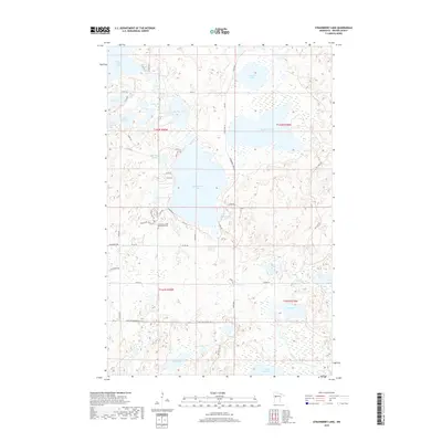
2019 Map of Strawberry Lake
USGS Topo · Published 2019About this map
Strawberry Lake serves as the centerpiece of this glaciated landscape in Becker County, where a dense network of water bodies and wetlands dictates the local geography. The area's spiritual and community roots are anchored at the Strawberry Lake Mennonite Cem near the intersection of Co Rd 34 and 323rd Ave. This lake-heavy terrain, featuring large basins like Big Rat Lake and White Earth Lake, is interconnected by minor waterways such as the Egg River and Ada River. A grid of local roads, including Mary Yellowhead Rd and S Sugar Bush Rd, provides access through the timbered tracts and around smaller water bodies like Pickle Lake and Chokecherry Lake. The map reveals a rural pattern of development where the natural hydrology remains the primary factor in land use and movement.
Find a feature on this map
50 named features on this map. Tap any name to fly to it.
Don’t see what you’re looking for? This feature index may not catch every label — zoom into the map to look around manually.
Map Details
Editions of this 2019 Strawberry Lake Map
This is the sole edition of this map. No revisions or reprints were ever made.
Other maps of this area

1953 · Brainerd
USGS Topo · 1:250,000

1954 · Bemidji
USGS Topo · 1:250,000

1957 · Brainerd
USGS Topo · 1:250,000

1957 · Bemidji
USGS Topo · 1:250,000

1958 · Bemidji
USGS Topo · 1:250,000

1958 · Brainerd
USGS Topo · 1:250,000

1959 · Flat Lake
USGS Topo · 1:24,000

1959 · Richwood
USGS Topo · 1:24,000

1959 · Height Of Land Lake
USGS Topo · 1:24,000

1965 · Brainerd
USGS Topo · 1:250,000