
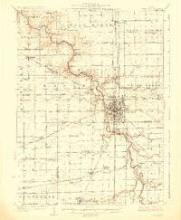
1927 Map of Streator
USGS Topo · Published 1927About this map
Streator serves as a dense industrial and transit hub in this mid-1920s survey, surrounded by the agricultural expanses of Farm Ridge and Grand Rapids. The Vermilion River carves a winding path across the landscape, flanked by a remarkably dense network of rural infrastructure. The map documents an era of small-scale educational and spiritual centers, with named schoolhouses like Paddy Ridge School and Shawback School punctuating nearly every square mile of the countryside.
Find a feature on this map
101 named features on this map. Tap any name to fly to it.
Don’t see what you’re looking for? This feature index may not catch every label — zoom into the map to look around manually.
Map Details
Editions of this 1927 Streator Map
2 editions found
Other maps of this area

1892 · Marseilles
USGS Topo · 1:62,500

1892 · Ottawa
USGS Topo · 1:62,500

1893 · Lasalle
USGS Topo · 1:62,500

1911 · La Salle
USGS Topo · 1:62,500

1913 · La Salle
USGS Topo · 1:62,500

1915 · Ottawa
USGS Topo · 1:62,500

1916 · Marseilles
USGS Topo · 1:62,500

1925 · Streator
USGS Topo · 1:62,500

1934 · Wenona
USGS Topo · 1:48,000

1935 · Pontiac
USGS Topo · 1:62,500