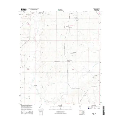
2015 Map of Street
USGS Topo · Published 2015About this map
The confluence of rural drainage systems and generations of family heritage marks this corner of Amite County. Both the West Fork Amite River and the East Fork Amite River dominate the landscape, joined by a dense network of tributaries including Felder Cr, Davis Cr, and Powell Cr. This complex hydrology dictated the settlement patterns of the area, seen in the winding paths of Street Rd and S Greensburg Rd.
Find a feature on this map
71 named features on this map. Tap any name to fly to it.
Don’t see what you’re looking for? This feature index may not catch every label — zoom into the map to look around manually.
Map Details
Editions of this 2015 Street Map
This is the sole edition of this map. No revisions or reprints were ever made.
Other maps of this area

1941 · Woodland
USGS Topo · 1:31,680

1941 · Chipola
USGS Topo · 1:31,680

1942 · Liverpool
USGS Topo · 1:31,680

1945 · Chipola
USGS Topo · 1:31,680

1953 · Natchez
USGS Topo · 1:250,000

1954 · Baton Rouge
USGS Topo · 1:250,000

1956 · Natchez
USGS Topo · 1:250,000

1956 · Baton Rouge
USGS Topo · 1:250,000
1958 · Felixville
USGS Topo · 1:62,500
1958 · Kentwood
USGS Topo · 1:62,500