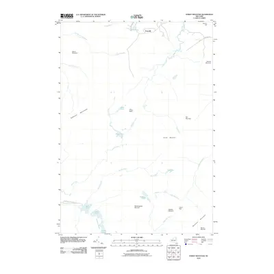
2010 Map of Street Mountain
USGS Topo · Published 2010About this map
Averyville serves as the primary point of human settlement on this map, situated in the northeast near the upper reaches of the Chubb River. The landscape is dominated by high peaks and remote water systems, including the Sawtooth Mountains and the massive profile of Street Mountain. Significant wilderness corridors are established here, notably the Northville-Lake Placid Trl which passes by Duck Hole and the Preston Ponds in the southwest.
Find a feature on this map
34 named features on this map. Tap any name to fly to it.
Don’t see what you’re looking for? This feature index may not catch every label — zoom into the map to look around manually.
Map Details
Editions of this 2010 Street Mountain Map
This is the sole edition of this map. No revisions or reprints were ever made.
Other maps of this area

1895 · Mt. Marcy
USGS Topo · 1:62,500

1896 · Lake Placid
USGS Topo · 1:62,500

1898 · Lake Placid
USGS Topo · 1:62,500

1902 · Mt. Marcy
USGS Topo · 1:62,500

1902 · Saranac
USGS Topo · 1:62,500

1904 · Saranac
USGS Topo · 1:62,500

1904 · Santanoni
USGS Topo · 1:62,500

1948 · Ogdensburg
USGS Topo · 1:250,000

1950 · Lake Champlain
USGS Topo · 1:250,000

1951 · Ogdensburg
USGS Topo · 1:250,000