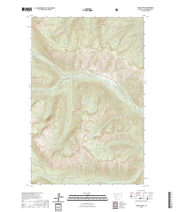
2024 Map of String Creek
USGS Topo · Published 2024About this map
Flathead National Forest and the Bob Marshall Wilderness dominate this high-elevation landscape, where deep drainages and sharp ridges define the territory. The topography is anchored by summits such as Chipmunk Peak, Tranquil Mtn, and Cinabar Mtn, which overlook a complex network of waterways including Bunker Creek and Gorge Creek. This modern survey highlights a remote wilderness infrastructure of named pack trails rather than paved roads, serving as a primary record of access for this protected interior.
Find a feature on this map
41 named features on this map. Tap any name to fly to it.
Don’t see what you’re looking for? This feature index may not catch every label — zoom into the map to look around manually.
Map Details
Editions of this 2024 String Creek Map
This is the sole edition of this map. No revisions or reprints were ever made.
Other maps of this area

1936 · Silvertip
USGS Topo · 1:96,000

1942 · Silvertip
USGS Topo · 1:125,000

1955 · Choteau
USGS Topo · 1:250,000

1957 · Choteau
USGS Topo · 1:250,000

1958 · Choteau
USGS Topo · 1:250,000

1962 · Choteau
USGS Topo · 1:250,000
1965 · Connor Creek
USGS Topo · 1:24,000

1965 · Sunburst Lake
USGS Topo · 1:24,000
1965 · Tin Creek
USGS Topo · 1:24,000
1965 · Thunderbolt Mountain
USGS Topo · 1:24,000