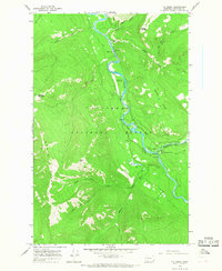
1965 Map of Tin Creek
USGS Topo · Published 1968About this map
South Fork Flathead River carves through this remote section of the Flathead National Forest, serving as the primary corridor for backcountry operations in the mid-1960s. The confluence with the Spotted Bear River marks a critical node of activity, centered around the Spotted Bear Ranger Station and its adjacent Spotted Bear Landing Field. This hub provided essential access for forest management and fire control long before modern road networks reached deep into the wilderness.
Find a feature on this map
27 named features on this map. Tap any name to fly to it.
Don’t see what you’re looking for? This feature index may not catch every label — zoom into the map to look around manually.
Map Details
Editions of this 1965 Tin Creek Map
2 editions found
Other maps of this area

1913 · Marias Pass
USGS Topo · 1:125,000

1914 · Nyack
USGS Topo · 1:125,000

1936 · Silvertip
USGS Topo · 1:96,000

1942 · Silvertip
USGS Topo · 1:125,000

1955 · Choteau
USGS Topo · 1:250,000

1957 · Choteau
USGS Topo · 1:250,000

1958 · Choteau
USGS Topo · 1:250,000

1958 · Circus Peak
USGS Topo · 1:24,000

1958 · Quintonkon
USGS Topo · 1:24,000

1958 · Horseshoe Peak
USGS Topo · 1:24,000