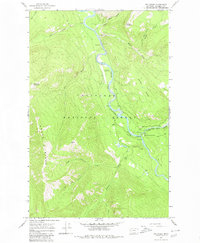
1965 Map of Tin Creek
USGS Topo · Published 1980About this map
Flathead National Forest encompasses the entirety of this mid-1960s landscape, centered on the confluence of the Spotted Bear River and the South Fork Flathead River. This area serves as a primary hub for forest management and back-country access, anchored by the Spotted Bear Ranger Station and its adjacent Spotted Bear Landing Field. The mapping records a system of Pack Trails and a Footbridge that provide the only passage through the high-elevation terrain of Bruce Ridge and Horse Ridge. Hydrological monitoring is evident through multiple Gaging Stations and a Cable Car crossing the river, reflecting the importance of water management in this drainage. Peaks like Soldier Mountain and Beacon Mountain dominate the skyline above the winding corridors of Tin Creek and Soldier Creek.
Find a feature on this map
26 named features on this map. Tap any name to fly to it.
Don’t see what you’re looking for? This feature index may not catch every label — zoom into the map to look around manually.
Map Details
Editions of this 1965 Tin Creek Map
2 editions found
Other maps of this area

1913 · Marias Pass
USGS Topo · 1:125,000

1914 · Nyack
USGS Topo · 1:125,000

1936 · Silvertip
USGS Topo · 1:96,000

1942 · Silvertip
USGS Topo · 1:125,000

1955 · Choteau
USGS Topo · 1:250,000

1957 · Choteau
USGS Topo · 1:250,000

1958 · Choteau
USGS Topo · 1:250,000

1958 · Circus Peak
USGS Topo · 1:24,000

1958 · Quintonkon
USGS Topo · 1:24,000

1958 · Horseshoe Peak
USGS Topo · 1:24,000