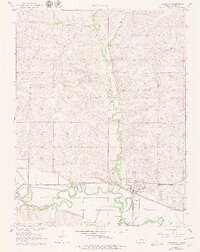
1957 Map of Strong City
USGS Topo · Published 1979About this map
The Cottonwood River meanders through the southern half of this Flint Hills landscape, defining the character of the region as it was surveyed in the late 1950s and updated in the 1970s. The settlement of Strong City (Strong) serves as a primary hub, anchored by the Atchison Topeka and Santa Fe railroad line that follows the river valley west toward Neva. The topographic detail illustrates a transition from the broad alluvial floor of Diamond Valley to the dissected upland hills drained by Fox Creek and Palmer Creek. Several historic burial sites, including Simmons Cem, St Anthony Cem, and Prairie Grove Cem, are scattered along the valley floor and lower slopes, offering valuable locations for genealogical research. Cultural landmarks such as the Rodeo Grounds near the river and various pits or utility structures like the Pipeline reflect the local agricultural and industrial footprint during this era.
Find a feature on this map
20 named features on this map. Tap any name to fly to it.
Don’t see what you’re looking for? This feature index may not catch every label — zoom into the map to look around manually.
Map Details
Editions of this 1957 Strong City Map
2 editions found

Other maps of this area

1885 · Eskridge
USGS Topo · 1:125,000

1888 · Emporia
USGS Topo · 1:125,000

1889 · Parkerville
USGS Topo · 1:125,000

1889 · Eskridge
USGS Topo · 1:125,000

1894 · Emporia
USGS Topo · 1:125,000

1894 · Eskridge
USGS Topo · 1:125,000

1894 · Parkerville
USGS Topo · 1:125,000

1898 · Cottonwood Falls
USGS Topo · 1:125,000

1955 · Hutchinson
USGS Topo · 1:250,000

1957 · Elmdale
USGS Topo · 1:24,000