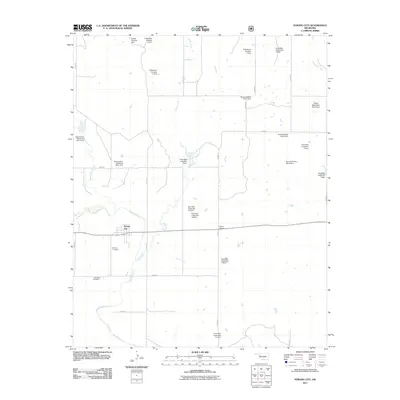
2011 Map of Strong City
USGS Topo · Published 2011About this map
Strong City and its surrounding watershed define this portion of Roger Mills County, where the Washita River meanders across a landscape dominated by water management and rural burial grounds. The settlement is anchored by Strong Cemetery, while the wider territory is marked by family-named landmarks and historical sites like Sankey Cemetery and Snake Bend Cemetery. This era reveals a sophisticated network of flood control structures, many bearing local family or site names including the Harold Mooney Dam and the various C Wickham and R Wickham impoundments.
Find a feature on this map
38 named features on this map. Tap any name to fly to it.
Don’t see what you’re looking for? This feature index may not catch every label — zoom into the map to look around manually.
Map Details
Editions of this 2011 Strong City Map
This is the sole edition of this map. No revisions or reprints were ever made.
Other maps of this area

1955 · Clinton
USGS Topo · 1:250,000

1957 · Clinton
USGS Topo · 1:250,000

1960 · Cheyenne
USGS Topo · 1:62,500

1960 · Hammon
USGS Topo · 1:62,500

1961 · Leedey
USGS Topo · 1:62,500

1966 · Roll
USGS Topo · 1:24,000

1966 · Roll SE
USGS Topo · 1:24,000

1984 · Foss Reservoir
USGS Topo · 1:100,000
1987 · Leedey SW
USGS Topo · 1:24,000

1987 · Big Kiowa Creek
USGS Topo · 1:24,000