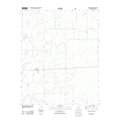
2012 Map of Strong City
USGS Topo · Published 2012About this map
Strong City serves as the primary hub of this Western Oklahoma landscape, positioned just north of the winding Washita River. The town layout is clearly defined by local thoroughfares such as Moore Ave and Nance Ave, reflecting a grid-based settlement pattern typical of the region's agricultural roots. The surrounding terrain is dissected by several watercourses including Wild Horse Cr, Caffey Cr, and Cofer Cr, which flow through the rolling plains toward the river.
Find a feature on this map
27 named features on this map. Tap any name to fly to it.
Don’t see what you’re looking for? This feature index may not catch every label — zoom into the map to look around manually.
Map Details
Editions of this 2012 Strong City Map
This is the sole edition of this map. No revisions or reprints were ever made.
Other maps of this area

1955 · Clinton
USGS Topo · 1:250,000

1957 · Clinton
USGS Topo · 1:250,000

1960 · Cheyenne
USGS Topo · 1:62,500

1960 · Hammon
USGS Topo · 1:62,500

1961 · Leedey
USGS Topo · 1:62,500

1966 · Roll
USGS Topo · 1:24,000

1966 · Roll SE
USGS Topo · 1:24,000

1984 · Foss Reservoir
USGS Topo · 1:100,000
1987 · Leedey SW
USGS Topo · 1:24,000

1987 · Big Kiowa Creek
USGS Topo · 1:24,000