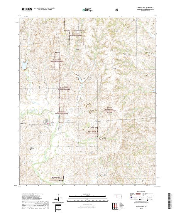
2022 Map of Strong City
USGS Topo · Published 2022About this map
The Washita River winds through this portion of Roger Mills County, anchoring a landscape defined by the fragmented blocks of the Black Kettle National Grassland. The small settlement of Strong City serves as the local hub, with its residential grid including N Moore Ave and Nance Ave. Genealogy and local history are well-preserved across the township lines, with several burial sites distributed throughout the countryside. These include Strong City Cem just south of the town site, Wagoner Cem in the northeast, and the curiously named Snakey Bend Cem near the river. The terrain is deeply dissected by a network of drainage systems, including Wild Horse Creek, Caffey Creek, and Ninemile Cr, illustrating the rugged drainage patterns characteristic of this western Oklahoma region.
Find a feature on this map
44 named features on this map. Tap any name to fly to it.
Don’t see what you’re looking for? This feature index may not catch every label — zoom into the map to look around manually.
Map Details
Editions of this 2022 Strong City Map
This is the sole edition of this map. No revisions or reprints were ever made.
Other maps of this area

1955 · Clinton
USGS Topo · 1:250,000

1957 · Clinton
USGS Topo · 1:250,000

1960 · Cheyenne
USGS Topo · 1:62,500

1960 · Hammon
USGS Topo · 1:62,500

1961 · Leedey
USGS Topo · 1:62,500

1966 · Roll
USGS Topo · 1:24,000

1966 · Roll SE
USGS Topo · 1:24,000

1984 · Foss Reservoir
USGS Topo · 1:100,000
1987 · Leedey SW
USGS Topo · 1:24,000

1987 · Big Kiowa Creek
USGS Topo · 1:24,000