
1951 Map of Strongs
USGS Topo · Published 1955About this map
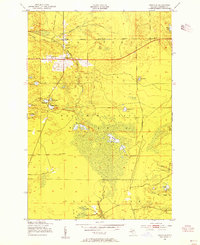
Strongs serves as the focal point for this section of the Upper Peninsula, situated at a junction of the Duluth South Shore and Atlantic railroad and several early roadways. The map reveals a tight-knit community structure through the presence of the Community Ch, Jones Sch, and the local Town Hall. Just to the south at Strongs Corner, the landscape transitions into the expansive Chippewa Marquette National Forest, where the terrain is defined by a complex network of wetlands and small water bodies like the Rice Lakes and Betchler Lakes.
Find a feature on this map
33 named features on this map. Tap any name to fly to it.
Don’t see what you’re looking for? This feature index may not catch every label — zoom into the map to look around manually.
Map Details
Editions of this 1951 Strongs Map
4 editions found
Other maps of this area

1931 · Epoufette NE
USGS Topo · 1:31,680

1941 · Strongs
USGS Topo · 1:63,360

1951 · McNearney Lake
USGS Topo · 1:24,000

1951 · Pendills Lake
USGS Topo · 1:24,000

1951 · Piatt Lake
USGS Topo · 1:24,000

1951 · Sullivan Creek
USGS Topo · 1:24,000

1951 · Eckerman
USGS Topo · 1:24,000

1951 · Strongs
USGS Topo · 1:62,500

1951 · Eckerman
USGS Topo · 1:62,500

1954 · Sault Sainte Marie
USGS Topo · 1:250,000