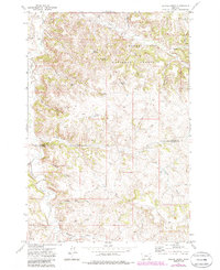
1972 Map of Stroud Creek
USGS Topo · Published 1986About this map
Custer National Forest lands dominate the northern reaches of this map, where the complex drainage systems of Stroud Creek and Lee Creek carve through the landscape. The geography is defined by a high concentration of water resources essential for ranching, including named springs like Rim Rock Spring and Dutchman Spring, alongside several man-made catchments such as Haywood Reservoir and Woodard Reservoir. The presence of the OW Ranch and numerous stock wells underscores the region's long-standing reliance on cattle ranching in the southern Montana grasslands.
Find a feature on this map
32 named features on this map. Tap any name to fly to it.
Don’t see what you’re looking for? This feature index may not catch every label — zoom into the map to look around manually.
Map Details
Editions of this 1972 Stroud Creek Map
2 editions found
Other maps of this area

1954 · Hardin
USGS Topo · 1:250,000

1957 · Hardin
USGS Topo · 1:250,000

1958 · Hardin
USGS Topo · 1:250,000

1966 · Browns Mountain
USGS Topo · 1:24,000

1966 · Poker Jim Butte
USGS Topo · 1:24,000

1967 · Birney
USGS Topo · 1:24,000

1967 · Lacey Gulch
USGS Topo · 1:24,000
1967 · Pine Butte School
USGS Topo · 1:24,000
1972 · Stroud Creek
USGS Topo · 1:24,000
1972 · Forks Ranch
USGS Topo · 1:24,000