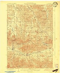
1930 Map of Strum
USGS Topo · Published 1930About this map
Strum and Eleva anchor the southern reaches of this landscape where the Buffalo River winds through the townships of Albion and Unity. This region of Trempealeau and Eau Claire counties is defined by a dense network of country schoolhouses, such as the Norwegian High School and York Valley School, which served the farming families scattered across the numerous valley systems like Sigmund Valley and Ramstead Valley. The transportation corridor of the Chicago St Paul Minneapolis and Omaha railroad parallels the river, facilitating the movement of goods between the small rail-stop villages. To the north, the terrain transitions into more rolling uplands near Cleghorn and Brackett, dotted with local landmarks like Zion Church and the Hadleyville Cemetery. The map captures a moment in time when the rural school and township system provided the primary social and educational framework for these central Wisconsin communities.
Find a feature on this map
62 named features on this map. Tap any name to fly to it.
Don’t see what you’re looking for? This feature index may not catch every label — zoom into the map to look around manually.
Map Details
Editions of this 1930 Strum Map
2 editions found
Other maps of this area

1926 · Whitehall
USGS Topo · 1:62,500

1927 · Blair
USGS Topo · 1:62,500

1927 · Strum
USGS Topo · 1:62,500

1929 · Whitehall
USGS Topo · 1:62,500

1930 · Strum
USGS Topo · 1:62,500

1932 · Gilmanton
USGS Topo · 1:62,500

1932 · Mondovi
USGS Topo · 1:62,500

1934 · Elk Mound
USGS Topo · 1:62,500

1934 · Chippewa Falls
USGS Topo · 1:62,500

1935 · Osseo
USGS Topo · 1:48,000