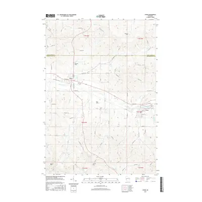
2015 Map of Strum
USGS Topo · Published 2015About this map
The Buffalo River winds through this central Wisconsin landscape, anchoring the valley communities of Eleva and Strum. This 2015 survey illustrates a rural region defined by sharp coulees and distinct named valleys such as Tolleston Valley and Berg Valley, where agriculture and topography dictate the winding paths of roads like Co Rd Y and Severson Rd. The conversion of older transport corridors is evident in the Buffalo River State Trl, which follows the river's path through the heart of both primary settlements.
Find a feature on this map
87 named features on this map. Tap any name to fly to it.
Don’t see what you’re looking for? This feature index may not catch every label — zoom into the map to look around manually.
Map Details
Editions of this 2015 Strum Map
This is the sole edition of this map. No revisions or reprints were ever made.
Other maps of this area

1926 · Whitehall
USGS Topo · 1:62,500

1927 · Strum
USGS Topo · 1:62,500

1929 · Whitehall
USGS Topo · 1:62,500

1930 · Strum
USGS Topo · 1:62,500

1932 · Gilmanton
USGS Topo · 1:62,500

1932 · Mondovi
USGS Topo · 1:62,500

1953 · Eau Claire
USGS Topo · 1:250,000

1958 · Eau Claire
USGS Topo · 1:250,000

1964 · Eau Claire
USGS Topo · 1:250,000
1973 · Cleghorn
USGS Topo · 1:24,000