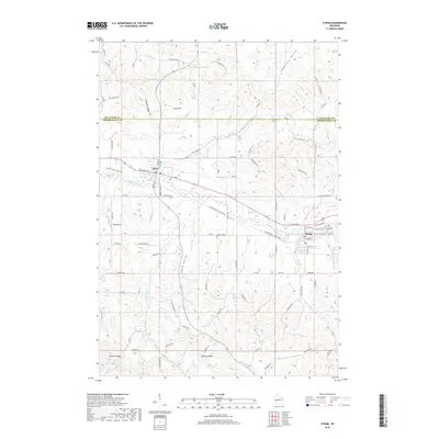
2018 Map of Strum
USGS Topo · Published 2018About this map
Strum and Eleva anchor this portion of the Buffalo River valley at the border of Eau Claire Co and Trempealeau Co. The landscape is defined by the river's meandering course and the adjacent Buffalo River State Trail, which traces the old rail corridor through the heart of the community. In addition to the larger bodies of water like Strum Lake and Eleva Pond, the terrain is deeply etched by a series of valleys and ridges, including Anderson Valley and Bennett Ridge.
Find a feature on this map
88 named features on this map. Tap any name to fly to it.
Don’t see what you’re looking for? This feature index may not catch every label — zoom into the map to look around manually.
Map Details
Editions of this 2018 Strum Map
This is the sole edition of this map. No revisions or reprints were ever made.
Other maps of this area

1926 · Whitehall
USGS Topo · 1:62,500

1927 · Strum
USGS Topo · 1:62,500

1929 · Whitehall
USGS Topo · 1:62,500

1930 · Strum
USGS Topo · 1:62,500

1932 · Gilmanton
USGS Topo · 1:62,500

1932 · Mondovi
USGS Topo · 1:62,500

1953 · Eau Claire
USGS Topo · 1:250,000

1958 · Eau Claire
USGS Topo · 1:250,000

1964 · Eau Claire
USGS Topo · 1:250,000
1973 · Cleghorn
USGS Topo · 1:24,000