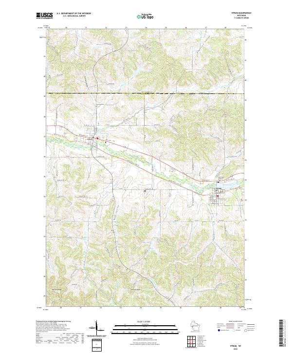
2022 Map of Strum
USGS Topo · Published 2022About this map
Strum and Eleva anchor this portion of the Buffalo River valley, where the modern landscape follows the contours of the Driftless Area's characteristic coulees and ridges. The Buffalo River State Trl traces the path of a former rail line, cutting a path through the valley between Strum Lake and Eleva Pond. The map reveals a high density of family-named valleys and ridges, such as Anderson Valley, Johnson Valley, and Bennett Ridge, which provide a clear look at the historic land division of this agricultural region. Genealogists will find several burial sites recorded, including the Eleva Cem, Hamlin Cem, and Saint Paul's Lutheran Cem near the eastern edge of the quadrangle. Distinctive natural landmarks like Chimney Rock stand out amidst a complex network of creeks, including Big Cr and Chimney Rock Cr, that drain toward the Buffalo River.
Find a feature on this map
92 named features on this map. Tap any name to fly to it.
Don’t see what you’re looking for? This feature index may not catch every label — zoom into the map to look around manually.
Map Details
Editions of this 2022 Strum Map
This is the sole edition of this map. No revisions or reprints were ever made.
Other maps of this area

1926 · Whitehall
USGS Topo · 1:62,500

1927 · Strum
USGS Topo · 1:62,500

1929 · Whitehall
USGS Topo · 1:62,500

1930 · Strum
USGS Topo · 1:62,500

1932 · Gilmanton
USGS Topo · 1:62,500

1932 · Mondovi
USGS Topo · 1:62,500

1953 · Eau Claire
USGS Topo · 1:250,000

1958 · Eau Claire
USGS Topo · 1:250,000

1964 · Eau Claire
USGS Topo · 1:250,000
1973 · Cleghorn
USGS Topo · 1:24,000