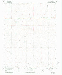
1968 Map of Stuart
USGS Topo · Published 1983About this map
Stuart serves as the focal point for this section of eastern Colorado, situated along the Missouri Pacific railroad line. The landscape is characterized by the agricultural patterns of the High Plains, where the presence of numerous Storage Bins and a Storage Bin near the rail corridor highlights the importance of grain transport to the local economy. Educational needs for the surrounding rural homesteads were met at the centrally located Plainview Sch, while a Water Tank and several wells suggest the infrastructure required to sustain life in this arid environment. The inclusion of the Budde Landing Strip reflects the era's reliance on small-scale aviation for connectivity across the wide stretches of Kiowa County. Additionally, the map traces a Pipeline cutting diagonally across the southern townships, marking the post-war expansion of industrial utilities through the region.
Find a feature on this map
13 named features on this map. Tap any name to fly to it.
Don’t see what you’re looking for? This feature index may not catch every label — zoom into the map to look around manually.
Map Details
Editions of this 1968 Stuart Map
2 editions found
Other maps of this area

1890 · Granada
USGS Topo · 1:125,000

1892 · Cheyenne Wells
USGS Topo · 1:125,000

1892 · Granada
USGS Topo · 1:125,000

1894 · Cheyenne Wells
USGS Topo · 1:125,000

1894 · Granada
USGS Topo · 1:125,000

1954 · Lamar
USGS Topo · 1:250,000

1958 · Lamar
USGS Topo · 1:250,000

1968 · Stuart
USGS Topo · 1:24,000

1968 · Sheridan Lake
USGS Topo · 1:24,000
1968 · Sheridan Lake SE
USGS Topo · 1:24,000