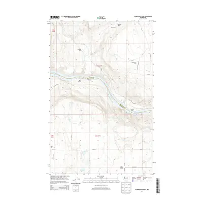
2014 Map of Stubblefield Point
USGS Topo · Published 2014About this map
Nilles Corner sits atop the high plateau south of the Columbia River, marking a quiet crossroads in a landscape defined by deep coulees and basalt rimrocks. The river itself dominates the central corridor, cutting through the canyon where Long Rapids, Eagle Rapids, and White Cap Rapids historically challenged navigation. Along the northern banks, the Colville Indian Reservation spans the terrain toward Stubblefield Point, while the southern Douglas County side is etched with family-named landmarks like Pearl Hill and several isolated water bodies including Judson Lake and the Klinkhammer Lakes. The complex topography is further revealed in the steep descent of Rice Canyon and Box Canyon, showing the dramatic elevation changes between the upland wheat country and the river valley. Numerous springs, such as Bryan Springs and Gladys Spring, dot the draws, highlighting the critical water sources for this arid region.
Find a feature on this map
46 named features on this map. Tap any name to fly to it.
Don’t see what you’re looking for? This feature index may not catch every label — zoom into the map to look around manually.
Map Details
Editions of this 2014 Stubblefield Point Map
This is the sole edition of this map. No revisions or reprints were ever made.
Other maps of this area

1905 · Okanogan
USGS Topo · 1:125,000

1950 · Boot Mtn
USGS Topo · 1:62,500

1953 · Ritzville
USGS Topo · 1:250,000

1954 · Okanogan
USGS Topo · 1:250,000

1957 · Bridgeport
USGS Topo · 1:62,500

1958 · Okanogan
USGS Topo · 1:250,000

1959 · Ritzville
USGS Topo · 1:250,000

1965 · Ritzville
USGS Topo · 1:250,000

1968 · Coleman Hill
USGS Topo · 1:24,000

1968 · Foster Coulee
USGS Topo · 1:24,000