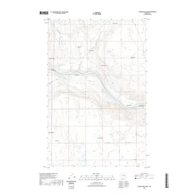
2020 Map of Stubblefield Point
USGS Topo · Published 2020About this map
Rufus Woods Lake carves through the center of this landscape, marking the boundary between Okanogan Co and Douglas Co. The waterway is defined by sharp geographic turns such as Gaviota Bend and notable hazards including Box Canyon and White Top Rapids. The surrounding plateau is characterized by numerous small bodies of water and basins, from the Achimin Basin in the north to the Klinkhammer Lakes in the south. The small settlement of Pearl Hill sits on the western heights above the river, connected by a network of rural routes like Pearl Hill Rd NE. For researchers, the map provides a look at the distribution of water resources in this arid region, documenting numerous family-named or descriptive water sources such as Miller Spring, Gladys Spring, and Lenner Spring that supported local ranching and settlement.
Find a feature on this map
37 named features on this map. Tap any name to fly to it.
Don’t see what you’re looking for? This feature index may not catch every label — zoom into the map to look around manually.
Map Details
Editions of this 2020 Stubblefield Point Map
This is the sole edition of this map. No revisions or reprints were ever made.
Other maps of this area

1905 · Okanogan
USGS Topo · 1:125,000

1950 · Boot Mtn
USGS Topo · 1:62,500

1953 · Ritzville
USGS Topo · 1:250,000

1954 · Okanogan
USGS Topo · 1:250,000

1957 · Bridgeport
USGS Topo · 1:62,500

1958 · Okanogan
USGS Topo · 1:250,000

1959 · Ritzville
USGS Topo · 1:250,000

1965 · Ritzville
USGS Topo · 1:250,000

1968 · Coleman Hill
USGS Topo · 1:24,000

1968 · Foster Coulee
USGS Topo · 1:24,000