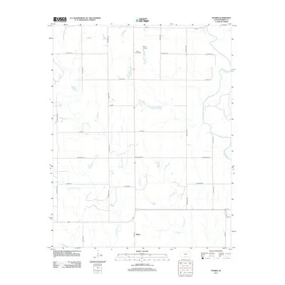
2012 Map of Stubbs
USGS Topo · Published 2012About this map
Stubbs and its surrounding rural prairie landscape appear in this 2012 survey of Barber County, Kansas. The geography is defined by the winding course of the Medicine Lodge River in the northeast and several intermittent tributaries, including Little Mule Cr and Little Driftwood Cr. While the area is primarily agricultural, the map documents several distinct named locations such as Talbott, Hargis, and Hawkins that serve as local landmarks for families and property owners in the region. The map provides a detailed view of the section-line road network, featuring routes like Rattlesnake Trl and Stubbs Rd. This modern survey also captures contemporary land use, including the Barber County Landfill and the rolling terrain of Black Kettle and Scott Canyon, illustrating the intersection of natural drainage systems and human infrastructure in the High Plains.
Find a feature on this map
23 named features on this map. Tap any name to fly to it.
Don’t see what you’re looking for? This feature index may not catch every label — zoom into the map to look around manually.
Map Details
Editions of this 2012 Stubbs Map
This is the sole edition of this map. No revisions or reprints were ever made.
Other maps of this area

1889 · Anthony
USGS Topo · 1:125,000

1891 · Medicine Lodge
USGS Topo · 1:125,000

1891 · Anthony
USGS Topo · 1:125,000

1893 · Medicine Lodge
USGS Topo · 1:125,000

1955 · Woodward
USGS Topo · 1:250,000

1955 · Pratt
USGS Topo · 1:250,000

1958 · Woodward
USGS Topo · 1:250,000

1959 · Pratt
USGS Topo · 1:250,000

1968 · Capron
USGS Topo · 1:24,000

1969 · Burlington
USGS Topo · 1:24,000