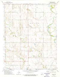
1973 Map of Stubbs
USGS Topo · Published 1975About this map
The Old Indian Treaty Boundary cuts across this prairie landscape just north of the border between Kansas and Oklahoma, marking a significant historical line through Barber County. The terrain is defined by the winding course of the Medicine Lodge River and its tributaries, including Little Mule Creek and Driftwood Creek. Along the southern edge of the survey, the small settlement of Stubbs sits near the Missouri Pacific railroad line, reflecting the importance of rail transport to these rural communities. Notable evidence of former infrastructure is visible in the north, where an Old Railroad Grade remains as a trace of earlier transit patterns. The map also documents the region's resource extraction, indicated by scattered gas and oil wells, particularly around Scott Canyon in the northern hills.
Find a feature on this map
21 named features on this map. Tap any name to fly to it.
Don’t see what you’re looking for? This feature index may not catch every label — zoom into the map to look around manually.
Map Details
Editions of this 1973 Stubbs Map
This is the sole edition of this map. No revisions or reprints were ever made.
Other maps of this area

1889 · Anthony
USGS Topo · 1:125,000

1891 · Medicine Lodge
USGS Topo · 1:125,000

1891 · Anthony
USGS Topo · 1:125,000

1893 · Medicine Lodge
USGS Topo · 1:125,000

1955 · Woodward
USGS Topo · 1:250,000

1955 · Pratt
USGS Topo · 1:250,000

1958 · Woodward
USGS Topo · 1:250,000

1959 · Pratt
USGS Topo · 1:250,000

1968 · Capron
USGS Topo · 1:24,000

1969 · Burlington
USGS Topo · 1:24,000