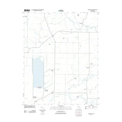
2012 Map of Sturdivant
USGS Topo · Published 2012About this map
The Eastern Ozark Border transitions into the river lowlands in this corner of Stoddard County, marked by a sophisticated water management system. The Duck Creek State Wildlife Refuge dominates the western half of the landscape, managed through a series of structures including the Duck Creek State Wildlife Refuge Number 1 Dam. This area is defined by its drainage patterns, where the Upper Castor River and the engineered Castor River Diversion Channel navigate the flat terrain alongside natural features like Cato Slough. Scattered throughout these bottomlands are established rural communities such as Arab, Greenbrier, and Sturdivant. Small family burial grounds, including the Cox Cemetery, Kimbrel Cemetery, and Sturdivant Cemetery, are located near these settlements, providing a preserved record of the local families who inhabited this junction of the Ozarks and the Mississippi embayment.
Find a feature on this map
59 named features on this map. Tap any name to fly to it.
Don’t see what you’re looking for? This feature index may not catch every label — zoom into the map to look around manually.
Map Details
Editions of this 2012 Sturdivant Map
This is the sole edition of this map. No revisions or reprints were ever made.
Other maps of this area

1934 · Bloomfield
USGS Topo · 1:62,500

1934 · Advance
USGS Topo · 1:62,500

1934 · Puxico
USGS Topo · 1:62,500

1935 · Zalma
USGS Topo · 1:62,500

1939 · Bloomfield
USGS Topo · 1:62,500

1939 · Advance
USGS Topo · 1:62,500

1939 · Puxico
USGS Topo · 1:62,500

1939 · Zalma
USGS Topo · 1:62,500

1949 · Paducah
USGS Topo · 1:250,000

1949 · Rolla
USGS Topo · 1:250,000