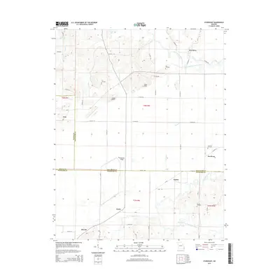
2015 Map of Sturdivant
USGS Topo · Published 2015About this map
The Upper Castor River and the Castor River Diversion Channel define the drainage of this southeast Missouri landscape, where the borders of Wayne, Bollinger, and Stoddard counties meet. Small settlements like Greenbrier, Sturdivant, and Kinder are connected by a network of county roads and former railroad alignments, including the Mo-P, Mo-K, and Mo-M. Several family and community burial sites, such as Cox Cemetery near Snake Bluff and Kimbrel Cemetery in the southern reaches, offer specific points of interest for genealogical research. The terrain is marked by distinctive elevations like Fears Bluff and Grapevine Ridge, while the lowland areas are characterized by features such as Cato Slough and Duck Creek. The proximity of Idlewild and Eaglette to these waterways suggests a landscape historically shaped by both agricultural needs and the management of the regional river systems.
Find a feature on this map
55 named features on this map. Tap any name to fly to it.
Don’t see what you’re looking for? This feature index may not catch every label — zoom into the map to look around manually.
Map Details
Editions of this 2015 Sturdivant Map
This is the sole edition of this map. No revisions or reprints were ever made.
Other maps of this area

1934 · Bloomfield
USGS Topo · 1:62,500

1934 · Advance
USGS Topo · 1:62,500

1934 · Puxico
USGS Topo · 1:62,500

1935 · Zalma
USGS Topo · 1:62,500

1939 · Bloomfield
USGS Topo · 1:62,500

1939 · Advance
USGS Topo · 1:62,500

1939 · Puxico
USGS Topo · 1:62,500

1939 · Zalma
USGS Topo · 1:62,500

1949 · Paducah
USGS Topo · 1:250,000

1949 · Rolla
USGS Topo · 1:250,000