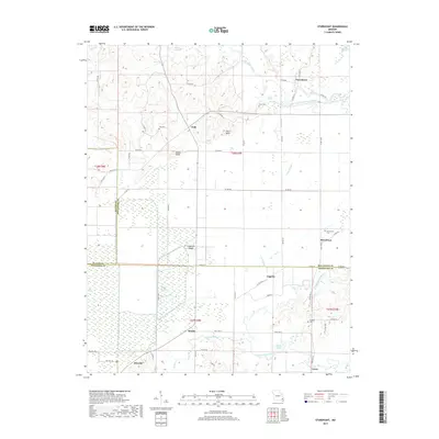
2017 Map of Sturdivant
USGS Topo · Published 2017About this map
Greenbrier and Arab anchor the northern landscape where the Upper Castor River meets the Castor River Diversion Channel. This 2017 survey reveals the complex drainage patterns of the Missouri Bootheel region, characterized by extensive wetlands like Mingo Swamp and Dark Cypress Swamp. The map documents a predominantly rural geography where small settlements such as Sturdivant, Kinder, and Eaglette are connected by a web of state highways and county roads. Notable family and local history landmarks are preserved through labels for Sturdivant Cem, Cox Cem, and Kimbrel Cem. The elevation transitions are marked by prominent features like Fears Bluff and Snake Bluff, while water management is evidenced by Pool Eight and the Cato Slough. This record captures the modern layout of these communities at the borders of Bollinger, Stoddard, and Wayne Counties.
Find a feature on this map
68 named features on this map. Tap any name to fly to it.
Don’t see what you’re looking for? This feature index may not catch every label — zoom into the map to look around manually.
Map Details
Editions of this 2017 Sturdivant Map
This is the sole edition of this map. No revisions or reprints were ever made.
Other maps of this area

1934 · Bloomfield
USGS Topo · 1:62,500

1934 · Advance
USGS Topo · 1:62,500

1934 · Puxico
USGS Topo · 1:62,500

1935 · Zalma
USGS Topo · 1:62,500

1939 · Bloomfield
USGS Topo · 1:62,500

1939 · Advance
USGS Topo · 1:62,500

1939 · Puxico
USGS Topo · 1:62,500

1939 · Zalma
USGS Topo · 1:62,500

1949 · Paducah
USGS Topo · 1:250,000

1949 · Rolla
USGS Topo · 1:250,000