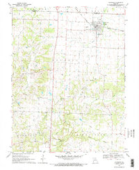
1969 Map of Sturgeon
USGS Topo · Published 1971About this map
Sturgeon serves as the primary hub of this north-central Missouri landscape, situated at the junction of the Norfolk and Western railway and several local township boundaries. This 1969 field-checked survey reveals a rural society structured by its family burial grounds and small community centers like Riggs. The terrain is defined by the dendritic drainage of Silver Fk, Lick Creek, and Grindstone Creek, with prominent geological features such as The Pinnacles standing out in the southern portion of the quadrangle. Genealogists will find a high density of rural cemeteries, including Mt Carmel Cem, Nailer Cem, and Locust Grove Cem, which often sit adjacent to country houses of worship like Locust Grove Ch. The presence of an Old Railroad Grade and various Quarries indicate the area's historical reliance on transit and stone extraction, while the Spillway Elev 754 reflects local water management practices of the era.
Find a feature on this map
34 named features on this map. Tap any name to fly to it.
Don’t see what you’re looking for? This feature index may not catch every label — zoom into the map to look around manually.
Map Details
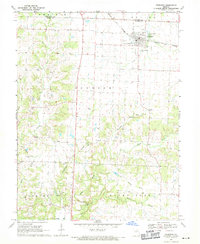
Editions of this 1969 Sturgeon Map
2 editions found
Other maps of this area

1890 · Moberly
USGS Topo · 1:125,000

1917 · Sturgeon
USGS Topo · 1:62,500

1945 · Centralia
USGS Topo · 1:62,500

1953 · Moberly
USGS Topo · 1:250,000

1953 · Renick
USGS Topo · 1:24,000

1953 · Clark
USGS Topo · 1:24,000

1954 · Moberly
USGS Topo · 1:250,000

1957 · Moberly
USGS Topo · 1:250,000

1958 · Tulip
USGS Topo · 1:24,000

1960 · Moberly
USGS Topo · 1:250,000