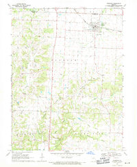
1969 Map of Sturgeon
USGS Topo · Published 1971About this map
Sturgeon sits at the intersection of the Norfolk and Western railroad and several county lines, serving as a hub for the surrounding agricultural prairie. The 1969 landscape is characterized by a dense network of family and community landmarks, including Mt Horeb Ch and a significant concentration of burial grounds such as Palmer Cem, Riggs Cem, and Nailer Cem. These features, alongside the smaller settlement of Riggs, provide a detailed look at the social and religious centers of Northern Boone County during this era.
Find a feature on this map
33 named features on this map. Tap any name to fly to it.
Don’t see what you’re looking for? This feature index may not catch every label — zoom into the map to look around manually.
Map Details
Editions of this 1969 Sturgeon Map
2 editions found
Other maps of this area

1890 · Moberly
USGS Topo · 1:125,000

1917 · Sturgeon
USGS Topo · 1:62,500

1945 · Centralia
USGS Topo · 1:62,500

1953 · Moberly
USGS Topo · 1:250,000

1953 · Renick
USGS Topo · 1:24,000

1953 · Clark
USGS Topo · 1:24,000

1954 · Moberly
USGS Topo · 1:250,000

1957 · Moberly
USGS Topo · 1:250,000

1958 · Tulip
USGS Topo · 1:24,000

1960 · Moberly
USGS Topo · 1:250,000