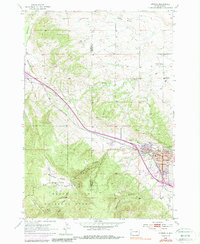
1954 Map of Sturgis
USGS Topo · Published 1988About this map
Sturgis serves as the focal point of this mid-century survey, positioned at the edge of the Black Hills National Forest. The town’s educational infrastructure is exceptionally well-documented, featuring the Williams Jr High Sch, Sturgis High Sch, and Erskine Sch within the city limits, while rural schoolhouses like Eden Sch and Boulder Park Sch serve the surrounding cattle and timber country. The Chicago and North Western railroad cuts a diagonal path through the terrain, passing near the prominent rise of Bear Butte and skirting the base of Sly Hill. The landscape transitions from the rugged elevations of Granite Peak and Oyster Mountain in the west to the alluvial valleys carved by Bear Butte Creek and Vanocker Creek. These drainages and the complex topography of Boulder Park reflect the transition from the Black Hills highlands to the plains of Meade County.
Find a feature on this map
31 named features on this map. Tap any name to fly to it.
Don’t see what you’re looking for? This feature index may not catch every label — zoom into the map to look around manually.
Map Details
Editions of this 1954 Sturgis Map
3 editions found
Other maps of this area

1893 · Rapid
USGS Topo · 1:125,000

1894 · Deadwood
USGS Topo · 1:125,000

1898 · Rapid
USGS Topo · 1:125,000

1899 · Sturgis
USGS Topo · 1:62,500

1901 · Deadwood
USGS Topo · 1:125,000

1903 · Rapid
USGS Topo · 1:125,000

1905 · Saint Onge
USGS Topo · 1:62,500

1906 · Vale
USGS Topo · 1:62,500

1907 · Belle Fourche
USGS Topo · 1:125,000

1913 · Newell
USGS Topo · 1:125,000