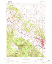
1954 Map of Sturgis
USGS Topo · Published 1972About this map
Sturgis serves as the gateway to the northern Hills in this mid-century survey, where the developing town site meets the wooded heights of the Black Hills National Forest. The map captures the community during a period of transition, showing the expanded urban footprint in purple against the original 1954 topography. Education and local infrastructure are well-documented, from town institutions like Sturgis High Sch and Williams Jr High Sch to the outlying Eden Sch and Boulder Park Sch in the Boulder Park settlement.
Find a feature on this map
31 named features on this map. Tap any name to fly to it.
Don’t see what you’re looking for? This feature index may not catch every label — zoom into the map to look around manually.
Map Details
Editions of this 1954 Sturgis Map
3 editions found
Other maps of this area

1893 · Rapid
USGS Topo · 1:125,000

1894 · Deadwood
USGS Topo · 1:125,000

1898 · Rapid
USGS Topo · 1:125,000

1899 · Sturgis
USGS Topo · 1:62,500

1901 · Deadwood
USGS Topo · 1:125,000

1903 · Rapid
USGS Topo · 1:125,000

1905 · Saint Onge
USGS Topo · 1:62,500

1906 · Vale
USGS Topo · 1:62,500

1907 · Belle Fourche
USGS Topo · 1:125,000

1913 · Newell
USGS Topo · 1:125,000