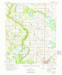
1971 Map of Stuttgart
USGS Topo · Published 1971About this map
Stuttgart anchors the southeastern corner of this Arkansas landscape, where the St Louis Southwestern and Chicago Rock Island and Pacific railroads meet. The terrain is defined by a complex network of bayous and drainage systems, including Two Prairie Bayou and La Grue Bayou, which support the region's agricultural character. This 1971 record shows the interplay of county lines, as Lonoke, Prairie, and Arkansas Counties all converge in this quadrangle.
Find a feature on this map
59 named features on this map. Tap any name to fly to it.
Don’t see what you’re looking for? This feature index may not catch every label — zoom into the map to look around manually.
Map Details
Editions of this 1971 Stuttgart Map
This is the sole edition of this map. No revisions or reprints were ever made.
Other maps of this area

1935 · Altheimer
USGS Topo · 1:62,500

1935 · Hazen
USGS Topo · 1:62,500

1935 · Clarendon
USGS Topo · 1:62,500

1937 · Stuttgart
USGS Topo · 1:62,500

1937 · England
USGS Topo · 1:48,000

1939 · Stuttgart
USGS Topo · 1:62,500

1940 · Lonoke
USGS Topo · 1:62,500

1941 · Hazen
USGS Topo · 1:62,500

1941 · De Witt
USGS Topo · 1:62,500

1941 · De Valls Bluff
USGS Topo · 1:62,500